
Bihar is one of the most important Eastern states of India. The state lays between 25�8' & 27�31' North Latitude and 83�20' & 88�17' East Longitude occupying an area of 94,163 sq. km. The average elevation of the state is 173 feet above the sea level. North of it lies Nepal while on other sides it shares the border with Indian states of Jharkhand (South), West Bengal (East) and Uttar Pradesh (West). Topographically Bihar can be grouped into three regions: The northern mountainous region, Indo-Gangetic Plain and southern Plateau. The Northern mountainous region consists of Someshwar and the Dun hills in the extreme Northwest in Champarn district. These hills are offshoots of the Himalayans system. South of it lies the Tarai region a belt of marshy, swampy, sparsely populated and unhealthy region.
The North Gangetic part of Bihar is just south of Tarai. This fertile alluvium tract is the product of various Himalayans and Peninsular rivers like Gandak, Budhi Gandak, Koshi, Mahananda, Bagmati, Gogra and Son and other small river and rivulets. Gangetic plain of Bihar is divided into north and south by Ganga river which is flowing through it. South Bihar Plain has some devegetated hummocky hills which have been subjected to continuous erosion by the rivers flowing through this region. To the further south of Bihar plain lies the plateau region which consists of Kaimur plateau in the west and Chhotanagpur plateau in the east. As the Indian sub-continent as a whole is adorned with monsoonal type of climate by the nature Bihar cannot go far away from this general climatic pattern.
Being located between 25 to 27 degree North latitude the climate of Bihar is of mostly sub-tropical. Nevertheless region close to Tropic of Cancer experiences tropical climate during summer. Like all the Indian states Bihar also reels under hot summer season during months of March to May. Average temperature is 35-40 Celsius throughout the summer months. April and June are the hottest months of the year. December to January is the winter season in Bihar because of its location is Northern hemisphere. The winter in Bihar is mild with average temperature being 5 to 10 degree Celsius. Bihar gets its maximum rainfall during South-West monsoon season which prevails from June to September. The average rainfall of Bihar is around 120 cm.
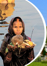
Bihar lies in transitional zone between the wet climate of West Bengal and North-Eastern Provinces and Semi arid climate of Western Uttar Pradesh. Thus the natural vegetation of Bihar is moist deciduous forests. These forests are mostly found in northern and southern parts of the state. As far as soil resources are concerned Bihar has three types of soil: montane, alluvium and marshy/swampy soil of Tarai. Demographic data of Bihar is also very interesting. According to 2001 Census, Bihar has a total population of 8.29 crores with an average density of 880 persons per sq. km. Bihar is dominated by rural flock which constitutes the 90% of the total population. More than half of the people (58%) are below 25 years and in their peak productive periods. Majority of the population (83%) are the followers of Hinduism while Islam is practised by 17% of the people.