
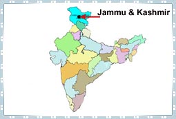
 The
valley of Kashmir occupies the topmost position in the map of India.
Kashmir, along with the region of Jammu, Ladakh and Gilgit forms the
State of Jammu and Kashmir. From the numerous valleys situated in the
state, Kashmir Valley is the biggest one, spread over an area of 105 sq
km. Located approximately 1730 m above the sea level; it has Tibet in
its east and Pakistan China and CIS in its west. The south of Kashmir is
bordered by Punjab, while on the southwest is Himachal Pradesh.
The
valley of Kashmir occupies the topmost position in the map of India.
Kashmir, along with the region of Jammu, Ladakh and Gilgit forms the
State of Jammu and Kashmir. From the numerous valleys situated in the
state, Kashmir Valley is the biggest one, spread over an area of 105 sq
km. Located approximately 1730 m above the sea level; it has Tibet in
its east and Pakistan China and CIS in its west. The south of Kashmir is
bordered by Punjab, while on the southwest is Himachal Pradesh.Jammu and Kashmir location is between 32.17" and 36.58" North altitude and East to West, the State lies between 73.26" and 80.30" longitude. In case of latitude, Jammu and Kashmir matches up with South Carolina (North America), Fez (Morracco), Damascus, Baghdad and Peshawar (Pakistan). The standard time in Kashmir is 5.30 hours ahead of Greenwich Mean Time (GMT) and has a difference of half an hour with the local time.
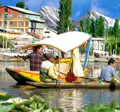
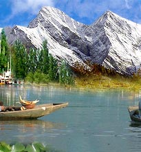
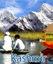
The geographical location of Kashmir is such that it is surrounded by a number of foreign countries. This makes the Kashmir valley very important from strategic angle. As far as the geography of Kashmir is concerned, the valley has River Jhelum flowing through it, along with its tributaries.


