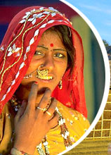
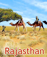
The largest state in India (by area), Rajasthan's
geography is quite varied. It is a region of lofty rocks, rolling sand
dunes, of burning heat and freezing cold, of fertile plains and deep
wild glens and jungles. Rajasthan is spread over 343,000 sq km. Running
across the state from Mt. Abu (in the southwest) to Khetri (in the
northeast) is the Aravali Range, the oldest folded range in the world.
This leads to an uneven division of the state, 60% in the northwest and
40% in the southeast.
As we move from northwest towards the east, the sandy, unproductive and
parched tract improves gradually to comparatively fertile and habitable.
The northeast area emerged from the desert itself. The southeast area is
more fertile, and has a quite diversified topography. It has hills,
woodlands, a number of large rivers, fertile tablelands and so on. The
southwestern Rajasthan consists of an arid high plateau, broken by hills
and cliffs.
The main source of water for the fields in Rajasthan, are the
irrigation dams or deep wells. There is also some forest area in
Rajasthan comprising of the forests of Alwar, Bharatpur and Sawai-
Madhopur. In these forests, you can find blue bull, tiger, wild boar,
panther, deer and so on. Rich alluvial soil makes up the level and flat
plains in this area. The major cultivation in Rajasthan consists of
wheat, maize, paddy and sugarcane in Kota and Bundi, in the Chittorgarh
and Bhilwara districts.

    |


