


 Assam is situated in the northeastern corner of India. Located between 24-28 degree north latitude and 90-96 degree east longitude, the state covers a total area of 78,523 square km or 30,318 square miles. It lies in close proximity of Bangladesh and Bhutan and is connected with the rest of India by the narrow Siligudi corridor. To its east lay Arunachal Pradesh, Nagaland and Manipur, while Tripura stands in the west and Meghalaya, Mizoram are sited to the south. Together with Assam, these states are called as the Seven Sister States of India.
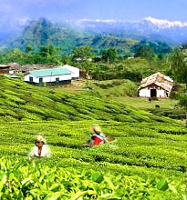
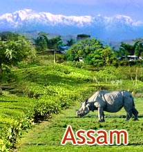
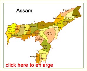
Known for its scenic beauty, Assam serves as a major attraction for travelers and adventure seekers. There is beauty and splendor etched in every corner of the state and it seems as though people, here, live in sync with nature. However, to know a place in and out, it is extremely necessary to have its map of in hand. This not only helps you plan your trip in a more systematic manner, but also avoids any confusion later on. So, check out the Assam state map that we have laid down for you here and plan a memorable and fun filled trip to the state. Bon Voyage!